
Ballina councillors to choose preferred route for long-awaited Alstonville shared path
Share This Story, Choose Your Platform!
A long-awaited shared path between Alstonville and Ballina has reached a major milestone, with councillors set to determine a preferred route at next week’s Ballina Shire Council meeting.
The project aims to provide a safe off-road connection between Alstonville, Wollongbar and West Ballina, creating a route for commuters, recreational cyclists and walkers.
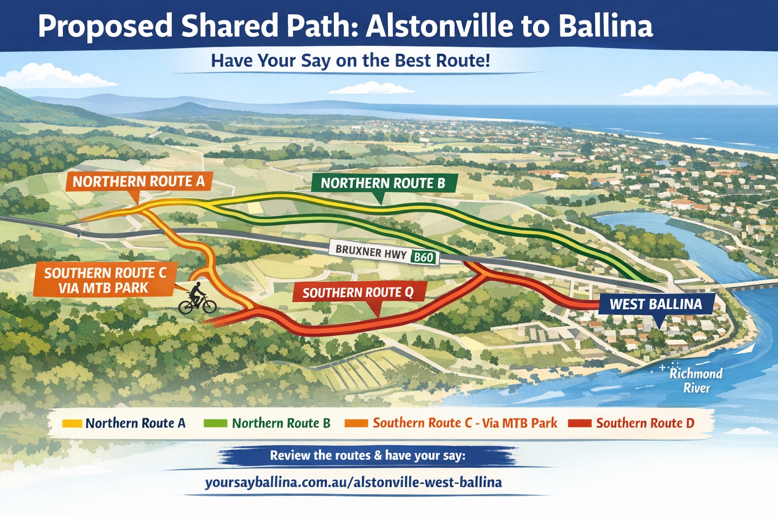
Council officers have recommended an “additional route” that combines sections of the previously exhibited northern and southern options. While it carries the highest estimated price tag of $36.5 million (excluding GST), the report argues it offers the best balance between user safety, directness, property impacts and long-term practicality.
The recommended alignment would follow the preferred northern route from Alstonville to the Mountain Bike Park before crossing beneath the Bruxner Highway and joining the preferred southern alignment into West Ballina.
Council says the combined route would avoid several engineering constraints near Alstonville Cemetery, reduce impacts on private landowners compared with the southern alignment and provide a more direct route through Alstonville that is likely to better match where cyclists and pedestrians want to travel.
The proposal follows public exhibition earlier this year, during which council received 55 online responses, six additional written submissions and submissions from 22 affected landowners. While many submissions questioned the project’s overall cost and potential impacts, the majority supported proceeding with the shared path and recognised its recreational, health, tourism and commuter benefits.
If endorsed, the project is expected to be delivered in stages, with the first priority likely to be a 4.4-kilometre section linking Alstonville to the Duck Creek Mountain Bike Park. That stage alone is estimated to cost $12.1 million, including contingency, and would provide a significant recreational asset while allowing council to seek future grant funding for the remaining sections.
Photo: Council officers have recommended an “additional route” that combines sections of the previously exhibited (pictured) northern and southern options.